 Using technology for asset and workforce management is an important issue for water utilities today. As the water utility infrastructure ages, water utilities are becoming more and more interested in wireless technologies to help manage information, assets and workers.
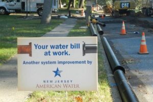
Five years ago, New Jersey American Water, one of American Water?s state subsidiaries, converted from an AutoCAD system to using a Geographic Information System (GIS) to manage its infrastructure, while Indiana American Water, another American Water state subsidiary, completed a similar conversion in 2010 and 2011. In addition to GIS desktop analysis and web mapping services, both companies launched a mobile GIS application specifically designed to increase operational efficiency and improve field worker productivity.
Support for Aging Infrastructure
 The U.S. Environmental Protection Agency (EPA) estimates that it will cost upwards of $1 trillion over the next 20 years to replace and repair our water and wastewater infrastructures. With aging infrastructure being one of the biggest challenges facing water and wastewater utilities today, GIS can offer significant time and cost savings related to maintaining an aging infrastructure.
Improved Customer Service
Improved customer service through operational efficiency is one of the key drivers for deploying field computing and wireless technologies for water and wastewater utilities.
Before mobile GIS was introduced, American Water utility employees received printed map updates roughly every three years. Workers would stick ?post-it notes? on maps to remind themselves of map errors and new installations. Often, these map corrections never made it to the map staff and, therefore, never were incorporated into new printed books, creating outdated and incorrect maps.
With mobile GIS, new map data is available every Monday morning and workers can now create digital notes, sending map error location and description directly to the GIS staff through the mobile GIS application. Additionally, the mobile system has a ?satellite view,? which allows workers to see curbs, catch basins, man holes, etc., and measure distances on screen. The GIS staff then receives the notes and corrects the map data, so that everyone benefits when the weekly update is available. Overall, turnaround time on map updating has improved from years to weeks.
Data updates for mobile GIS maps are sent to field tablets via the internet, however, the data is then stored locally on the computer. As a result, mobile GIS is very fast, reliable and unlike web maps, it requires no internet connection while in field to operate. Field staff can annotate map errors while disconnected from the network, and when a connection becomes available, they can post those notes to GIS staff for correction (Figure 2).
For the office-based GIS professional, updating a deployed GIS mobile map for hundreds of users takes only 30 minutes, and can be updated as often as needed. Map revisions are now ?crowd sourced? from a field staff of over 200 workers, exponentially enhancing the research ability of fewer than five GIS editors. Mobile GIS manages more accurate, current information about the utility?s distributed assets, making the most current data reliably accessible to field workers. ?
Fast Repairs and Eliminating Future Leaks
 Field workers also use mobile maps to precisely locate main repair locations, a tool that is invaluable for the engineering staff. For example, main break locations participate in a GIS model that evaluates the overall health of a main, taking into consideration other factors like age, diameter, material, criticality, history of complaints, etc. Better location of main repairs help make this comprehensive model more accurate, ensuring precious infrastructure renewal dollars are spent wisely. The system is not only saving New Jersey American Water a significant amount of time, it?s also helps them allocate money wisely to prevent future leaks.
Environmental Benefits
In this fast-paced technological world, more and more water utilities are replacing heaps of paper reports, work orders and stocky hard-copy map books with real-time digital documents and maps. Updating an old printed book out of GIS took three weeks start to finish. The books were very expensive and immediately out of date. Mobile GIS eliminates annual printing costs as well as saving ink and roughly 200 thousand sheets of paper.
More than Mapping
Mobile GIS is more than an ordinary automated mapping tool. As GIS matures, it has the potential to display every connection in the community, allowing workers to instantly identify individual customers affected by company work, outages and more. Mobile GIS will soon integrate with enterprise work order management.
As part of the company?s commitment to customer service, operational excellence and the delivery of high-quality, reliable drinking water, American Water is looking to implement mobile GIS for field workers in additional states in the future.
Chris Kahn is the GIS project manager at New Jersey American Water, providing high-quality and reliable water and/or wastewater services to approximately 2.5 million people.
Steve Taylor is a GIS technician at Indiana American Water, providing high-quality and reliable water and/or wastewater services to approximately 1.2 million people.
The mobile GIS application has been released to all major distribution centers and to specific field personnel at New Jersey American Water and Indiana American Water. It is unique and helpful to the employees who use it for many reasons:?
- GIS integrates into an enterprise information system framework.
- Multiple functions within a utility can access GIS for improving operations, capital planning and other business applications.
- Allows you to view, understand, question, interpret and visualize data in many ways that reveal relationships, patterns and trends in the form of maps, globes, reports and charts.
- Helps you answer questions and solve problems by looking at data in a way that is quickly understood and easily shared.
- Combines hardware, software and data for capturing, managing & statistically analyzing and displaying all forms of geographically referenced information.


Leave a Reply