Building flood storage basins and creating a wide storm-water drainage channel on Milwaukee’s north side are part of a proposed $139.3 million plan to help combined sanitary and storm sewers carry away water from heavy rains and prevent property damage in the south end of the 30th St. industrial corridor.
In addition to reducing flooding and basement backups, such storm-water controls are a necessary step in the redevelopment of industrial land along the Canadian Pacific Railway as well as residential neighborhoods to the east and west, according to city and?Milwaukee Metropolitan Sewerage District?officials.
Designing storm-water relief started soon after more than 1,000 properties in the south end of the corridor reported water or sewage in basements from July 22, 2010, storms that poured several inches of rain on the north side, MMSD officials said.
Street flooding was reported at 35 locations in the area, stretching from W. Townsend Ave. south to the Menomonee River. This is one of the city’s oldest areas. Historic neighborhoods and industrial blocks were developed originally before 1930.
In the July 22, 2010, deluge known locally as the?Brew City Flood,?one rain gauge measured 8.31 inches of water in 24 hours on the northeast side, with a maximum of 6.73 inches in one hour. Another gauge measured 3.74 inches of rain in one hour.
As sewers filled, the water filled streets and flowed overland. A 19-year-old Cudahy man died July 22 after?floodwaters pushed his car into Lincoln Creek. Torrential rains were blamed for?combined sewer overflows of 1.985 billion gallons?in central Milwaukee and eastern Shorewood, and a separate sewer overflow of 171 million gallons, between July 22 and 25, 2010.
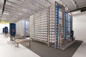
One response to the property damage and loss of life is the ?30th St. Industrial Corridor South Stormwater Plan? approved Monday by the MMSD commission.
In December, the commission approved a?storm-water control plan for the north end of the corridor,?north of W. Capitol Drive to Lincoln Creek. Total property acquisition and construction costs for the north corridor flood control plan are estimated at $46.1 million.
Century City Included
At the center of the full corridor is vacant former industrial space, now known as Century City, south of Capitol Drive. This is the former A.O. Smith/Tower Automotive plant, and it is targeted for redevelopment with a business park, light industrial employers and a mix of housing.
The south corridor encompasses a 4,000-acre drainage area northwest of downtown with dense residential blocks, but the proposed plan will depend on large areas of open space to store and convey water, Public Works Commissioner Ghassan Korban said.
?So we will need to create it,? Korban said in explaining the high cost of land purchases in the plan.
Cost of land acquisition and demolition of buildings to make space available for storm-water controls and the flood basins is estimated at $30.7 million.
The south corridor plan’s recommended first step is installation of 5,000 flow restrictors in street drain inlets to the combined sewers, said Jerome Flogel, a senior project manager with the Milwaukee Metropolitan Sewerage District. The estimated cost of buying and installing the restrictors is $1 million.
Those restrictors would be placed throughout the area. Boundaries generally extend from Townsend Ave. south to the Menomonee River, and from Washington Park and N. 43rd St. east to N. 20th St.
Use of restrictors would reduce flows of storm water in the combined sewers and help prevent backups of sewage in basements. Basement backups are the most widespread problem in the south corridor and likely were under-reported in the July 2010 storms, Flogel said.
Another piece of the plan aimed at blocking clear water from combined sewers in the south corridor is a goal of disconnecting up to 50% of downspouts from sanitary sewer laterals connected to the municipal pipes.
Milwaukee’s Department of Public Works has several years of successful experience with use of small numbers of inlet restrictors in two other north side neighborhoods, said Tim Thur, engineer-in-charge of the department’s environmental engineering section.
The devices do limit the volume of stormwater runoff entering combined sewers, but extra steps must be taken to ensure streets do not become flooded and a hazard to pedestrians and motorists, he said.
Water blocked from entering the storm-water inlets would accumulate a few inches high on streets, under the plan, and the pavement would drain to a minimum of six flood storage basins excavated along the corridor, Flogel said.
The plan by consultant CDM Smith recommends the basins be large enough to store a minimum of 19.5 million gallons of storm water.
A handful of streets that could not drain adequately would be equipped with storm sewers to draw water directly to the nearest basin, as part of the south corridor plan. Cost of engineering and constructing the basins is estimated at $54.1 million.
As basins fill, water would drain to the channel, known as a greenway, in the center of the corridor, Flogel said. The greenway would extend about 2.6 miles from W. Auer Ave. south to W. Vliet St. and it would cost an estimated $24.9 million to design and build, under the plan.
This channel would carry floodwater south, or downstream, to a large 1.5-mile-long storm sewer proposed to be built from Vliet St. west to the Menomonee River. Cost of this storm sewer is estimated at $12.6 million. Among the other plan recommendations is a recreational path in the greenway.
Information in this news article was taken from a report by the Milwaukee Journal Sentinel.


Leave a Reply