For many years, the need to accurately map underground utilities was not a priority for cities and utilities. But as the underground space has become increasingly congested and development has encroached on what had been open land, knowing the precise location of pipelines is becoming more and more critical.
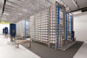
In the past, there were technological barriers to achieving precise mapping of buried utilities. That is changing in North America, however, as Geospatial Corp. is offering its Smart Probe mapping and database solutions for a variety of industries that rely on underground pipelines.
Geospatial Corp. is a Pittsburgh-based company founded in 2007 by Mark Smith, a veteran of the municipal water and sewer market who recognized the need for mapping data and found the technology that could get the job done.
The Smart Probe technology used by Geospatial emerged from Europe where it was pioneered during the telecom boom of the 1990s. Similar to the United States, Europe was experiencing rapid construction of buried fiber-optic conduit and the need to accurately map the location of these new pipelines arose.
?Mark Smith has extensive experience in the underground market and municipal pipe rehab market,? said Todd Porter, Geospatial executive vice president. ?He understood the industry, and when he saw the technology, he immediately saw the opportunity.?
Geospatial has performed projects for owners involved in a range of utilities, from municipal clients to companies including Sunoco, Comcast and Qwest. Design firms and subsurface utility engineering companies have also turned to Geospatial?s technology.
Smart Probe Technology
The Smart Probe technology can be used for centerline 3D mapping of a variety of utility pipelines, municipal (water, sanitary, storm systems), electrical and power (transmission and distribution), telecom, facilities (government, military, shipping ports), and oil and gas (transmission, gathering, distribution).
The Smart Probe technology consists of two main components. The first is an array of data collection instruments, which include accelerometers, gyroscopes and odometers located within each of the probe bodies. The second is a post-mission software package that extracts, computes and interprets the collected data and allows for the seamless transfer of the collected data into various GIS databases.
As the probe moves through the pipeline, it records all changes in inclination, heading and velocity at 800 Hz and stores the information internally on the probe. Once inserted into the pipeline, the probe operates autonomously ? there is no umbilical or surface communication required ? at a speed of about 6 feet per second.
The Smart Probe operates in a relative coordinate frame, measuring a continuous centerline 3D trajectory. Registering and correcting the probe is achieved by GPS survey (accuate to plus or minus 0.10 m) of entry, exit and intermediate points along the pipeline route for long sections. This provides the absolute XYZ pipeline positions for horizontal and elevation points in any datum or coordinate system worldwide. By transferring the complete pipe centerline into AutoCAD or a GIS database, accurate XYZ registration creates the baseline or validation of the true location of the asset.
A key goal in developing the smart probe technology was to design the instrumentation in such a way that it is capable of being used within a series of different probe body styles that would allow for the use of the technology within a wide range of pipeline types, sizes and environments. Configuration can be scaled for 1.5-in. to 60-in. and bigger applications.
New Approach
The Town of Oak Island, N.C., is a community of 9,000 year-round residents situated along the Atlantic Coast about halfway between Wilmington, N.C., and Myrtle Beach, S.C. In 2005, the Town made the decision to install a vacuum sewer system to treat its wastewater, eliminating the use of septic tanks. Without a treatment plant of its own, the Town needed to install a sewer forcemain under the Intercoastal Waterway to convey wastes to the West Brunswick Regional Reclamation Facility on the mainland.
To install the new 20-in. diameter forcemain, the Town decided to use directional drilling for the 1,500 ft crossing. However, the Town and its engineer, Black & Veatch, had difficulty locating an existing water line that had been installed in the 1990s as a secondary water supply source. In fact, as crews were drilling to install the new sewer forcemain, it was discovered that they had encountered the existing water line.
?We saw cuttings on the drill bit, and when we turned on the water line we saw silt and mud, so we knew the line had been breached,? said Troy Davis, the Town?s assistant public services director for construction. ?Once we knew the line had been damaged, we needed to find its location and assess its condition. We knew where the pipe started and where it ended, but that was all we knew.?
Oak Island turned to Geospatial?s Smart Probe to accurately identify the location of the waterline. The company inserted a protective pipe sleeve in which the probe was inserted, and ran the probe until it could not go any further. The process was then repeated from the mainland side.
?Once we had the information from each side, we were able to connect the dots to determine the location of the pipe,? Davis said. ?As it turned out, the pipe was filled with debris and we decided to abandon it because it was not feasible to repair a line 20 ft below the bottom of the Intercoastal Waterway.?
Oak Island also used the technology to verify the location of a 900-ft directional bore under a marshy area that was recently installed as part of the vacuum sewer system that is being built. After running the Smart Probe through the section of pipe, the Town discovered that the new sewer was 25 ft above its planned vertical alignment. As a result, the Town paid a reduced price to the contractor, and, perhaps more importantly, is armed with information that could avoid a potentially costly accident in the future ? both from an environmental and financial standpoint.
Pipeline Projects
Sunoco is an energy provider with roots dating back more than 100 years. Not surprisingly, Sunoco owns an extensive array of underground oil and gas pipelines built at various times throughout its history. This pipe network requires numerous repair, replacement and relocation, and the company has turned to 3D mapping to ensure that projects ? and future projects ? go smoothly.
In a recent project in Tyler, Texas, Sunoco was relocating a 12-in. line under a Texas Department of Transportation highway. Texas? Highway 49 was being widened and drainage installed, so Sunoco decided to relocate its line to a deeper location using horizontal directional drilling. By Texas DOT requirement, Sunoco needed to provide accurate as-builts of its facilities on DOT rights of way, so it turned to Geospatial.
By using the Smart Probe technology, Sunoco was able to provide accurate GPS coordinates to Texas DOT, as well as verify its pipeline was free of deformations that may have occurred as a result of drilling operations. Sunoco can then use the data to maintain an accurate inventory of its facilities going forward.
Upon successful completion of the mapping project in Texas, Sunoco used it for two similar projects in Oklahoma. ?In these instances, the owner entities did not require us to provide as-builts, but we were interested in achieving the same level of information,? said William Chaparro, Sunoco project manager for pipeline relocations. ?The process is simple and fast, and we have the precise locations of our new lines.?
Work Process and Deliverables
The complete mapping operation can take as long as a few hours to possibly a full day. The most involved
step of the process is to string the pipeline. In some cases, the survey has been completed in less than one hour. The steps needed to map the pipelines are:
- GPS survey the entry and exit points on the pipeline. This generally is done before reconnect and backfill.
- Complete cleaning and/or dewatering.
- Open entry and exit ends of pipeline.
- String the pipeline with forced air or compressor.
- Complete the Smart Probe mapping; pull the tool forward and backward (complete round trip) twice (for quality control purposes).
- Download data, perform quality control inspections.
But the process is only the beginning. Information is the heart of the process. The Smart Probe survey report deliverables include:
- AutoCAD plan and profile as-built (3D referenced to the provided survey coordinates)
- PDF version of the AutoCAD depiction
- Comma Separated Value (CSV) file documenting the horizontal coordinates (X, Y) and elevation (Z) in 1-ft intervals along the length of the conduit bore
- Google Earth image (KMZ) file referencing the plan view of the conduit
- GeoUnderground , a web-based portal that allows customers to access subscription-based information from any computer.
Looking Ahead
As long as the population continues to increase, the need for utilities will continue to grow. Additionally, aging infrastructure continues to be a driver in the underground pipeline repair and replacement market. That means opportunities for technology like Geospatial?s Smart Probe. ?There are utilities out there tripping over each other, and it?s getting worse by the day,? Porter said.? ?There is a great need to integrate data between disparate agencies, and we are well-positioned as a third party to be able to do that. It is a phenomenal growth opportunity.?
Additionally, having accurate information allows better designs and fewer surprises during construction. ?With good accuracy you are able design and execute an engineering plan and efficiency,? Porter said. ?It is also fundamental to tracking your assets and managing risk and exposure.?
Geospatial this year announced a strategic partnership with Ridge Global, headed by former Pennsylvania Governor and Homeland Security Secretary Tom Ridge, and Pace Energy that combines Geospatial?s Smart Probe pipeline mapping technologies and GeoUnderground web-based secure 3D geographic information system database with Pace?s energy expertise and Ridge Global?s expertise in preparedness, security and resiliency to meet the growing challenges that businesses and governments face today.
In September, Geospatial agreed to license its Smart Probe technology for Florida-based engineering firm George F. Young Inc., which will have non-exclusive use of the Smart Probe and GeoUnderground in the Southeast and Caribbean.
Porter said that as the technology spreads, even more opportunities will arise. ?The reaction we have had from our clients has been really positive,? he said. ?Once they see the results, they can begin to see what they can do with the information.?
Jim Rush is editor of UIM.