Satellite Imaging Offers Accurate, Cost-Effective Distribution System Monitoring
By Shane Majetich & Lauren Guy
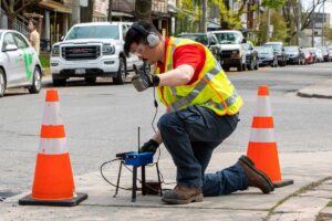
Today, utilities around the world utilize hardware-based monitoring systems and/or acoustic leak detection technologies as their primary tools for managing non-revenue water. They have been established as tried and tested, result-driven technologies. However, these approaches to monitoring non-revenue water are also notoriously labor intensive and smart infrastructure monitoring requires significant capital investment.
New technology solutions are being introduced to the U.S. market designed to address these challenges, including one revolutionary method from Hydromax USA. The Utilis solution, developed by a water management company based in Israel, is a new way of detecting non-revenue water leaks by analyzing spectral images from satellites. This innovative technology has been adapted from the search for water on other planets, underscoring its high reliability and outstanding capability on Earth. The solution offers a non-invasive method to the problem of urban water leakage.
Satellite spectral analysis uses remote sensing of subterranean water leakage based on a proprietary algorithm that detects underground leaks through the analysis of micro spectral satellite imagery. Thousands of square miles of water distribution network can be assessed at once, with the ability to pinpoint a leak within a few meters radius. As compared to traditional acoustic surveying of the distribution system designed to identify points for further correlation, no field work is required to achieve this level of information. Microwave satellite images are received as the input, after which a mathematical algorithm and analysis is performed to provide the exact coordinates of the leak. In addition, analysis estimates the size of the leak — from as little as 0.02 gallons per minute — with the ability to detect leaks 6 to 15 ft underground. The data is additionally filtered to remove lakes, swimming pools, drainage assets, sewage assets and other interferences, allowing for an accurate assessment of water distribution system leaks.
By identifying leaks within a few meters radius, the technology is able to detect leaks effectively. The outputs of the software are used to analyze satellite images and display a layer of water leaks within a web-based GIS application. This innovative remote sensing technology layer is unique and immediately accessible to water managers.
Most importantly, satellite spectral analysis does not require any prior investment or adaptation of existing distribution systems. As such, it is an extremely cost-effective solution and result is much lower operational costs for reducing non-revenue water. It also allows for water managers to spend their budgets more efficiently by being able to look at an urban grid in its entirety, from space.
Background
The concept of utilizing commercially available satellite images to detect water distribution system leaks originated with Lauren Guy, who used these images to look for water on other planets while working with Hebrew University and Ben-Gurion University in Israel. Following this, Guy went to work for Rimon, a privately-held operator in Israel, and became aware of the vast challenge of water distribution system leakage. Guy decided to put his knowledge of microwave imaging to practical use in remote sensing.
“There are leak detection solutions using infrared or thermal imaging but no one else we know of is using microwave imaging from satellites without setting a foot on the field,” he says. Guy, along with Eran Nevo, formerly vice president of research and development at email marketing firm Truvle, and now Utilis CEO, founded Utilis in 2013. Guy wrote the algorithms and Nevo has led the company to a successful launching in international markets.
Remote Sensing
The patented technology detects freshwater leaks in water distribution systems by analyzing multispectral images and presenting its findings on a web-based, Geographical Information System (GIS). With state-of-the-art technology that is known for finding water on other planets, Utilis locates leaks on Earth by relying on airborne-mounted sensors (satellites). By overlaying a layer of identified leaks on a map together with streets, pipes and leak size information, the resulting leak detection technology can concurrently cover thousands of square miles.
To do this, the algorithm searches for the spectral ‘signature’ of fresh water (a dielectric constant). This signature is the relation between an electromagnetic wavelength and its interaction with water. Satellites work by sending out electromagnetic waves which bounce back to them from Earth. Depending on the substance they touch on or under the ground, the electromagnetic waves that bounce back have a wide range of spectral signatures. The key to its ability to detect leaks in urban distribution pipes is in its focus on the spectral signature of fresh water, filtering out everything else.
The technology utilized is based on microwave reflectometry, or microwave electromagnetic signals. Microwaves travel through atmospheric interferences such as clouds, dust particles and aerosols. They work well at any time of the day or night. They are particularly useful for water detection, as water exhibits a high value of relative dielectric permittivity, therefore enabling the discovery and measurement of water in soil. Water sources such as pipes, lakes or swimming pools reflect electromagnetic waves, both underground and above ground levels. Utilis selected a specific microwave wavelength not only for its ability to penetrate the ground, but also due to its high sensitivity to fresh water characteristics. The core technology exploits these physical findings and then removes undesired “noise” reflections of buildings, vegetation and other topographical features. A high-level breakdown of the process is as follows:
- A microwave sensor acquires images.
- An algorithm is used to prepare raw data for analysis.
- A corrected microwave image is then analyzed with freshwater leaks identified. The size of the leaks is estimated by cross referencing the algorithm’s output against local infrastructure.
- Normalized data is presented graphically with findings displayed on a GIS web-based application. Hydromax USA field teams or utility personnel receive access to the client web interface as well as traditional leak sheets generated by the system, to confirm and repair the leaks.
An example of a Utilis leak sheet showing the coordinates of a possible leak. Leaks can be pinpointed to within a few meters radius. Analysis estimates the size of the leak — from as little as 0.02 gallons per minute — with the ability to detect leaks 6 to 15 ft underground.
The key features of microwave imagery are:
- Satellite leak detection provides an efficient and accurate survey of a very large area, the perimeter of which can cover an entire water system in a single screening. Instead of taking a year or longer to survey an entire system, periodic updates on the whole system can be obtained multiple times per year.
- With each satellite scan, a considerable number of leaks are identified for on-ground assessment. With the satellite findings, Hydromax USA or utility field teams correlate and verify anywhere from 5 to 15 leaks per day. The results over time are consistent and lead to significant reductions of non-revenue water.
- The minimal detectable leak size is 0.02 gallons per minute.
- Integration with GIS data: the system output is cross-referenced with data covering the location such as water mains in the distribution system.
- Remote sensing does not require hardware investment or changes to existing infrastructure. Input is received from satellite sensors and integrated with utility system data.
- Evaluate technology by its effectiveness in reducing non-revenue water, economically and logistically.
The Opportunity Cost
Unlike smart water management systems, satellite leak detection does not require an initial investment in hardware. Instead, it uses electro-acoustic techniques to drive efficiency in identifying and confirming leaks in the distribution system. When compared with other leak detection solutions, such as searching for leaks by surveying large areas by foot, or by analyzing data from a deployed hardware networks, the technology provides utilities a cost-effective way to monitor their entire distribution system multiple times throughout the year without the significant investment in human and financial resources. The entire network can be surveyed up to 12 times per year, providing multiple sets of findings to drive acoustic correlation teams on the ground, raising the effectiveness of field teams so that they can focus on the last few feet of a detected leak. This results in identifying more leaks in the same time period when compared with using a smart water management system or acoustic leak detection surveys. Coupled with the opportunity to identify leakage in the subsequent surveys that may have gone undetected for a year or longer, this solution allows utilities to capture the recurring loss more proactively, further enhancing revenue recovery.
An example of a Utilis leak sheet showing the coordinates of a possible leak. Leaks can be pinpointed to within a few meters radius. Analysis estimates the size of the leak – from as little as 0.02 gallons per minute – with the ability to detect leaks 6 to 15 ft under ground.
Going Forward
In the coming months, Hydromax USA will be demonstrating the effectiveness of the Utilis solution to clients through pilot and subscription programs designed to show how the solution can eliminate the need to perform annual acoustic audits of their system. Research and development teams continue to advance the analysis of the satellite data and web interfaces and are focusing further effort on further reducing the diameter of the leak location identified.
Shane Majetich is manager of national water distribution system services for Hydromax USA and has developed water infrastructure assessment programs impacting hundreds of thousands of water systems assets. He provides expertise in the assessment of aging water infrastructure through the implementation of technology-based solutions providing actionable infrastructure information for clients’ water network assets.
Lauren Guy is chief technology officer of Utilis Inc., has a Bachelor of Science in geomorphology and remote sensing and a Master of Science in geophysics with a vast knowledge in academic research. During his academic venture Guy has operated methods to detect water signals on foreign planets such as Venus and Mars. He co-founded Utilis in 2013 with a way to enhance those methodologies for locating liquids on other planets to locating underground leaks on Earth.